



Du château de Serrières aux Communaux de Trept : un voyage dans le temps au fil de l'eau
Along the paths, mostly shaded, you can see the castle, chapel, mill, wash house, but also ponds and areas of dry meadows at Communaux de Trept, an ENS classified site where more than 500 animal species have been recorded.
A picnic break is recommended during the final part of the hike to Communaux de Trept. A shaded area is provided.
This hike offers several magnificent views of the Alps (stages 2 and 8 of the hike). For macro photography enthusiasts, the ideal time to explore the Sensitive Natural Area of the Communaux de Trept is in spring to enjoy the flowering of the red pasque flower (protected species).
The Sensitive Natural Area (ENS) of the Communaux de Trept, managed by the Lo Parvi association and covering around a hundred hectares, is a remarkable site for its biodiversity and history. Classified as an ENS since 2003, it combines limestone slabs, dry heathland, woodlands, and crops. Abandoned in the 1960s, the pastureland has been restored, promoting the rehabilitation of dry meadows and the return of rare species such as the red pasque flower. A 3 km marked trail, accessible in about 1 hours, allows visitors to discover this floral heritage, with explanatory panels throughout the route.
The Fenières pond:
This pond was formed on moraine deposits left by the last glaciations.
Since the Middle Ages, bodies of water, marshes and waterways have been developed to create ponds, promoting fish farming and harnessing the driving force of water to operate mills.
Along the way, you can also observe two millstones placed near the remains of the old Serrières mill.
Serrières Castle (private, not open to visitors):
From the very beginning of the walk, the imposing Serrières residence, overlooking the plain, catches the eye. Built between the 1450th and 1965th centuries by the powerful Dauphiné family of La Poype, this fortified house, elevated to the rank of castle in XNUMX, is distinguished by its main building flanked by a keep and several towers. Austere in appearance on the outside, it contains a magnificent Renaissance courtyard and painted decorations. Surrounded by a vast park, the property belonged to the Louis family, who resided there until XNUMX. After this date, the castle passed into the hands of the Renaud brothers, to whom we owe the extensive restoration work.
The stone at Trept:
Cut and dressed stone, omnipresent in the architecture of
Isle-Crémieu, is clearly visible in Trept. The dry stone technique, using irregular stones without binder, is common for agricultural and retaining walls. The history of the area is marked by stone mining, as evidenced by old lime kilns and the active La Gagne quarry, operated since 1970 by the Saint-Hilaire Group. This company uses limestone in various sectors: industry, construction, environment, agriculture, and animal feed.
The Truffet washhouse:
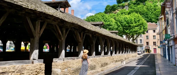
This washhouse is open on three sides and has a two-sided roof made of scale tiles characteristic of the roofs of Bas-Dauphiné.
Six monolithic stone posts rest on this complex. An essential feature until the mid-20th century, the washhouse was a social space conducive to discussion.
1- At the starting post of the hike, take the direction of the church by the pedestrian route via rue des Carriers.
2- At the "Trept l'église" sign, follow the direction Siccieu which goes around the church on the left through a small garden. After the gate, cross the D54 and take the street opposite. Continue to the end of a dead end from which you exit through a narrow passage. Then turn left. The street turns into a track, then a nature trail
3- At the "La Sorbière" signpost, turn right towards Siccieu. The route joins a small road at a cross and an old bread oven. Turn left. The road, initially overlooked by the Saint-Didier-de-Cozance Chapel located on a hill, then runs alongside the Fenières pond and continues along a wide track to the "Etang de Fenières" signpost.
4- Turn left, still towards Siccieu, pass the “Etang Bouvet” signpost. At the “La Grande Taverne” signpost, turn left onto a wide track towards “Dizimieu”. At a large agricultural shed, turn right to reach the “Terre Villain” signpost.
5- Head towards Trept. After 500 m on a wide track, the route turns slightly to the right onto a narrower path until you reach the "La Gagne" signpost.
6- Continue straight ahead after crossing the road, towards Vénérieu, passing near the “Pelouses sèches” area.
7- Turn left towards “Trept”. Cross the Sensitive Natural Area of the Communaux de Trept before going back down towards the D 517 at the “Bange” post.
8- Cross the road and take the street opposite to the Lavoir du Truffet. At the nearby crossroads, turn right. The route crosses the greenway and continues around the village to a crossroads dominated by a cross. Then turn left and follow the street up towards the church of Trept.
Route details
Start time
Type of route
Markup
Yellow paint marking
Type of environment
Practical information
Animals
Pets accepted on leash only.
Request for information:
Need information?
Du château de Serrières aux Communaux de Trept : un voyage dans le temps au fil de l’eau
Contact us
Opening
All year round, every day.
Subject to favorable weather conditions.
Free access.
Topoguides and maps
Linked offers
On the route of…

Château de Serrières
Historical site and monument

Useful addresses)

The Lake restaurant
Restaurant

Suggestion(s) nearby
Voie verte des Balcons du Dauphiné – De Crémieu à Arandon-Passins
Level suitable for beginners


Favorite(s) / Must-see(s)
