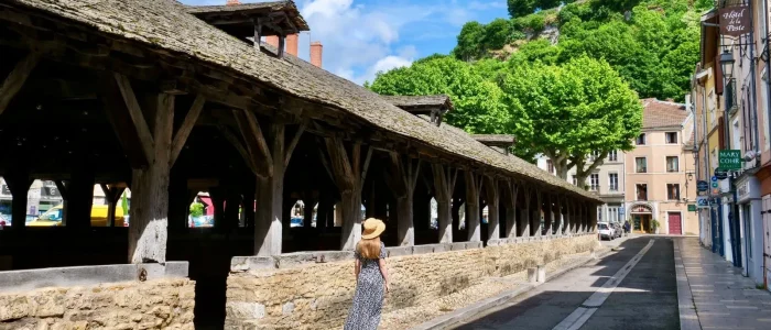

Au pays de la pierre, tour de Parmilieu par le sentier des bigues


Quarries were operated in Parmilieu from 1740 to extract Villebois stone.
This hike, where stone is omnipresent, will allow you to learn more about this quarry basin whose heritage and landscapes are closely linked.
Plan a break at the old Brosses quarry (stage 2 of the hike). Don't miss the source of the quarrymen and take the time to appreciate this atypical place.
Parmilieu and his careers:
Stone extraction mainly developed in the 30th century. Parmilieu then had up to 200 active quarries and employed more than XNUMX stonecutters organized as a corporation.
In a quarry, stone workers are divided into 2 categories: quarrymen and cutters.
The quarrymen must extract the stone blocks from the quarry face. The cutters are responsible for shaping the blocks according to orders.
Today, quarrying has greatly diminished, but this activity is still very present in our region, which has developed expertise that is recognized worldwide. Villebois stone has been used, among other things, for the construction of the quays of the Rhône, for the hall of the Wall Street stock exchange in New York, and also for the construction of the Stade de France!
1 – From the town hall square, head towards the war memorial. Continue left to pass in front of the church and reach the “la Bascule” signpost (320 m). Continue left on the sidewalk to the “Chonou” crossroads (329 m).
2 – Follow the road on the left which turns into a wide track to reach “Pressieu” (322 m).
Go left towards the centre of the hamlet. At the next crossroads, turn right then immediately left. Follow the track to the “Les Brosses” post (267 m).
3 – Climb the path on the left towards 3 de Chanoz. Walk along the path and join the departmental road. Go along on the left until the cross and turn right to cross the hamlet.
4 – At the “Chanoz” post (282 m), take the direction of Parmilieu. After a few meters, leave the road on the right and take the track. To find the Senin at the level of the Puits Jacob road.
5 – Go straight and after the village at the wash house, take the path of Pierres Plantées on the left. Continue on the track to find the D52j road. Then follow the sidewalk on the right
to the “Parmilieu” post (332 m). And reach the starting car park on the left.
Route details
Start time
Parking in the Parmilieu Town Hall car park.
Type of route
Markup
Yellow paint marking
Type of environment
Practical information
Animals
Pets accepted on leash only.
Request for information:
Need information?
Au pays de la pierre, tour de Parmilieu par le sentier des bigues
Contact us
Opening
All year round, every day.
Subject to favorable weather conditions.
Free access.
Topoguides and maps
Linked offers
On site / Allows access to…

Useful addresses)

Le Val d’Amby
Hotel restaurant


Suggestion(s) nearby


Les grottes de La Balme
Bookable online. From €13 per adult.
